Monday, February 20, 2012

Review and Course Map - Livestrong Austin Marathon

2/19/2012 - Review of the Livestrong Austin Marathon in Austin TX
The 21st annual Livestrong Austin Marathon, run through the hilly roads of Austin surrounded by supporting crowds and indie rock bands. Review and course map are below.

After the race at gear pick up


Distance: 26.2 miles
Course: The marathon started on the north side of the capital and ended on the south side of the capital. The course is an eight shape, we ran south on congress ave and then back north on first ave. At that point the marathon course headed west for about a mile or 2 and then north for additional 5-6 miles. we then ran east and down south through UT Austin to the finish line at the capital. Detailed map is below.
Crowd: Elite and recreational runners and Austinians
The easy part: Perfect weather, course was appropriately staffed with hydration stations
The challenging part: The course is hilly, my total elevation gain was over 700ft, even the last 5 mile which are mostly down hill end with a steep climb to the finish line. Keep that in mind
Price: $100-$130
Pacers: Yes, you can run with one of the many pacers group.
Timing: Chip on shoe
Qualifying: None
Official website: Livestrong Austin Marathon
My 2 cents: I have ran more scenic and entertaining courses than that, however Austin's night life is awesome so if you are coming out of town to run it spend another day or two to taste everything this amazing city has to offer.


Thanks for reading and as always please don't hesitate to email/reach out with any questions.
Thanks!

runnersreviews.blogspot.com/


MUST READ: By reading parts or all of this blog, the reader (“You”) understand that trying on your own, some or all of the reviews (in part or in full) in this blog is potentially hazardous activity. You should not participate in running or walking or jogging or any other form of physical activity (collectively known as “Activities”) on the trails or courses or races (collectively known as “Paths”) reviewed unless you are medically able and properly trained. In any event, your Activities taking place in the Paths reviewed in this blog will be solely at your own risk under your full responsibility and under no circumstances shall the author and owner of this blog have any liability for direct or indirect physical or mental damages/injuries or death or damage/loss to your valuables or belongings as a direct or indirect result of your decision to participate in Activities based on reviews in this blog.

The author of this blog does neither represent nor warrants that the reviews in this blog are accurate or provide accurate representation of the prevailing conditions including but not limited to course, weather, surface condition or animals at the time you will choose to participate in Activities based on the reviewed Paths. The reviews were accurate strictly for the time at which they were explored and ran or walked by the author and should not be relied upon for planning or doing your Activities.

These are mountain, unpaved trails and paved road courses; some are away from medical services. The Paths have numerous risk factors which include, just to name a few out of many others, rattlesnakes, coyotes, mountain lions, ticks, poison oak, and other potentially dangerous and harmful animals, vegetation, fire hazards,  and other dangerous and harmful elements. Wearing sun block will protect your skin and should be taken into your consideration before exposing your skin to the sun.

If you choose to participate in Activities based on one, some or all of the reviewed Paths you assume all risks associated with your Activities, including varying and/or existing potentially harmful or hazardous weather conditions including but not limited to high heat and/or humidity, varying and/or existing conditions of the trails and roads, animals, poison oak, and traffic on the Paths including travel to and from the Paths, and including but not limited to trips, slides or falls of cliffs or steep slopes and contacts with other participants, all such risks being known and appreciated by you, and including all direct or indirect injuries or death that may be suffered before, during, or after an Activities.

It is highly recommended to perform the Activities as part of a group of multiple people. In addition it is highly recommended that you will carry essentials which include but are not limited to at least 64 Oz. of water, 4 energy bars, map of the area with a marked course, watch, GPS, cellular phone and a first-aid kit.

By reading parts or all of this blog and choosing to run, walk or physically follow any of the courses, trails or races reviewed you for yourself and anyone entitled to act on your behalf, unconditionally and with no reservations waive and release the author and owner of this blog, its agents and representatives, and all sponsors, their representatives and successors from all claims or liabilities of any kind arising directly or indirectly out of your participation in Activities based on the reviews in this blog.


Sunday, February 5, 2012

Trail run review and course map Canyonback Rd. and Mandeville Canyon Rd.

2/5/2012 - Trail run review and course map Canyonback Rd. and Mandeville Canyon Rd., Los Angeles,CA

Run along Canyonback Rd with spectacular ocean and valley views and return through the cool Mandeville Canyon Rd.


Course map, photos and details are below.

Distance: 12.85 miles
Course: The run start and end points are at the end of N Kenter Ave.run north on Canyonback Rd. until it connects with Mulholland Dr. where the run will head west until the Nike Radar station make a left hand turn, after 0.25 there are water and bathrooms, keep running south and take stay to the left to run down the fireroad to Mandeville Canyon Rd. run down and make a right hand turn heading south. Look for Hollyhock PL where you will turn left and run up a steep hill back to Canyonback Rd. and back to the start point. This run should be slightly less than 11 miles, I wanted to add a few miles so ran back on Canyonback Rd. to get to almost 13 miles. Up to you and what you are training for!
Looking south down Kenter Ave from the start

Valley views from Canyonback Rd

Canyonback Rd looking north towards the Nike Radar Station

Ocean views from Canyonback Rd

More Ocean views

The easy part: Not very technical, running up the ridge is a moderate climb
The challenging part: Hollyhock PL is a steep climb over only ~0.7miles
Price: N/A
Pacers:N/A
Timing:N/A
Qualifying: None
Official website: N/A
My 2 cents: Run smart, save energy for Hollyhock!


Thanks for reading and as always please don't hesitate to email/reach out with any questions.
Thanks!

runnersreviews.blogspot.com/


MUST READ: By reading parts or all of this blog, the reader (“You”) understand that trying on your own, some or all of the reviews (in part or in full) in this blog is potentially hazardous activity. You should not participate in running or walking or jogging or any other form of physical activity (collectively known as “Activities”) on the trails or courses or races (collectively known as “Paths”) reviewed unless you are medically able and properly trained. In any event, your Activities taking place in the Paths reviewed in this blog will be solely at your own risk under your full responsibility and under no circumstances shall the author and owner of this blog have any liability for direct or indirect physical or mental damages/injuries or death or damage/loss to your valuables or belongings as a direct or indirect result of your decision to participate in Activities based on reviews in this blog.

The author of this blog does neither represent nor warrants that the reviews in this blog are accurate or provide accurate representation of the prevailing conditions including but not limited to course, weather, surface condition or animals at the time you will choose to participate in Activities based on the reviewed Paths. The reviews were accurate strictly for the time at which they were explored and ran or walked by the author and should not be relied upon for planning or doing your Activities.

These are mountain, unpaved trails and paved road courses; some are away from medical services. The Paths have numerous risk factors which include, just to name a few out of many others, rattlesnakes, coyotes, mountain lions, ticks, poison oak, and other potentially dangerous and harmful animals, vegetation, fire hazards,  and other dangerous and harmful elements. Wearing sun block will protect your skin and should be taken into your consideration before exposing your skin to the sun.

If you choose to participate in Activities based on one, some or all of the reviewed Paths you assume all risks associated with your Activities, including varying and/or existing potentially harmful or hazardous weather conditions including but not limited to high heat and/or humidity, varying and/or existing conditions of the trails and roads, animals, poison oak, and traffic on the Paths including travel to and from the Paths, and including but not limited to trips, slides or falls of cliffs or steep slopes and contacts with other participants, all such risks being known and appreciated by you, and including all direct or indirect injuries or death that may be suffered before, during, or after an Activities.

It is highly recommended to perform the Activities as part of a group of multiple people. In addition it is highly recommended that you will carry essentials which include but are not limited to at least 64 Oz. of water, 4 energy bars, map of the area with a marked course, watch, GPS, cellular phone and a first-aid kit.

By reading parts or all of this blog and choosing to run, walk or physically follow any of the courses, trails or races reviewed you for yourself and anyone entitled to act on your behalf, unconditionally and with no reservations waive and release the author and owner of this blog, its agents and representatives, and all sponsors, their representatives and successors from all claims or liabilities of any kind arising directly or indirectly out of your participation in Activities based on the reviews in this blog.


Saturday, February 4, 2012

Review and course map of Ocean Front 6K run, Santa Monica CA.

2/4/2012 - Review and course map of Ocean Front 6K run, Santa Monica CA.

Sunday afternoon 6K training run, flat and fast! course map and details are below.


Distance: 3.77 miles
Course: The run start and end at the intersection of Pacific Coast Highway (PCH) and Temescal Canyon Road. Run south on the ocean front path for ~1.875 miles and turn around to the starting point 
Crowd: Recreational runners
The easy part: Flat, ocean views, stunning sunset
The challenging part: Nothing really, the more you push the harder it will be so totally up to you
Price: N/A
Pacers:N/A
Timing:N/A
Qualifying: None
Official website: N/A
My 2 cents: The path is ideal for various training sessions, you can mix it up and run intervals, sprints or just jog a very long run.


Thanks for reading and as always please don't hesitate to email/reach out with any questions.
Thanks!

runnersreviews.blogspot.com/


MUST READ: By reading parts or all of this blog, the reader (“You”) understand that trying on your own, some or all of the reviews (in part or in full) in this blog is potentially hazardous activity. You should not participate in running or walking or jogging or any other form of physical activity (collectively known as “Activities”) on the trails or courses or races (collectively known as “Paths”) reviewed unless you are medically able and properly trained. In any event, your Activities taking place in the Paths reviewed in this blog will be solely at your own risk under your full responsibility and under no circumstances shall the author and owner of this blog have any liability for direct or indirect physical or mental damages/injuries or death or damage/loss to your valuables or belongings as a direct or indirect result of your decision to participate in Activities based on reviews in this blog.

The author of this blog does neither represent nor warrants that the reviews in this blog are accurate or provide accurate representation of the prevailing conditions including but not limited to course, weather, surface condition or animals at the time you will choose to participate in Activities based on the reviewed Paths. The reviews were accurate strictly for the time at which they were explored and ran or walked by the author and should not be relied upon for planning or doing your Activities.

These are mountain, unpaved trails and paved road courses; some are away from medical services. The Paths have numerous risk factors which include, just to name a few out of many others, rattlesnakes, coyotes, mountain lions, ticks, poison oak, and other potentially dangerous and harmful animals, vegetation, fire hazards,  and other dangerous and harmful elements. Wearing sun block will protect your skin and should be taken into your consideration before exposing your skin to the sun.

If you choose to participate in Activities based on one, some or all of the reviewed Paths you assume all risks associated with your Activities, including varying and/or existing potentially harmful or hazardous weather conditions including but not limited to high heat and/or humidity, varying and/or existing conditions of the trails and roads, animals, poison oak, and traffic on the Paths including travel to and from the Paths, and including but not limited to trips, slides or falls of cliffs or steep slopes and contacts with other participants, all such risks being known and appreciated by you, and including all direct or indirect injuries or death that may be suffered before, during, or after an Activities.

It is highly recommended to perform the Activities as part of a group of multiple people. In addition it is highly recommended that you will carry essentials which include but are not limited to at least 64 Oz. of water, 4 energy bars, map of the area with a marked course, watch, GPS, cellular phone and a first-aid kit.

By reading parts or all of this blog and choosing to run, walk or physically follow any of the courses, trails or races reviewed you for yourself and anyone entitled to act on your behalf, unconditionally and with no reservations waive and release the author and owner of this blog, its agents and representatives, and all sponsors, their representatives and successors from all claims or liabilities of any kind arising directly or indirectly out of your participation in Activities based on the reviews in this blog.


Ocean Front 10 miles run, Santa Monica CA

1/29/2012 - Review and course map of Ocean Front 10 miles run, Santa Monica CA.

Sunday afternoon 10 miles training run, flat and fast! course map and details are below.


Distance: 10.39 miles
Course: The run start and end at the intersection of Pacific Coast Highway (PCH) and Temescal Canyon Road. The course of the run was a 3.1 miles south on the ocean front path and back to the start point. Then, additional ~4 miles were added by running north, turning around to run south and back to the starting point. 
Crowd: Recreational runners
The easy part: Flat, ocean views, stunning sunset
The challenging part: Nothing really, the more you push the harder it will be so totally up to you
Price: N/A
Pacers:N/A
Timing:N/A
Qualifying: None
Official website: N/A
My 2 cents: The path is ideal for various training sessions, you can mix it up and run intervals, sprints or just jog a very long run.


Thanks for reading and as always please don't hesitate to email/reach out with any questions.
Thanks!

runnersreviews.blogspot.com/


MUST READ: By reading parts or all of this blog, the reader (“You”) understand that trying on your own, some or all of the reviews (in part or in full) in this blog is potentially hazardous activity. You should not participate in running or walking or jogging or any other form of physical activity (collectively known as “Activities”) on the trails or courses or races (collectively known as “Paths”) reviewed unless you are medically able and properly trained. In any event, your Activities taking place in the Paths reviewed in this blog will be solely at your own risk under your full responsibility and under no circumstances shall the author and owner of this blog have any liability for direct or indirect physical or mental damages/injuries or death or damage/loss to your valuables or belongings as a direct or indirect result of your decision to participate in Activities based on reviews in this blog.

The author of this blog does neither represent nor warrants that the reviews in this blog are accurate or provide accurate representation of the prevailing conditions including but not limited to course, weather, surface condition or animals at the time you will choose to participate in Activities based on the reviewed Paths. The reviews were accurate strictly for the time at which they were explored and ran or walked by the author and should not be relied upon for planning or doing your Activities.

These are mountain, unpaved trails and paved road courses; some are away from medical services. The Paths have numerous risk factors which include, just to name a few out of many others, rattlesnakes, coyotes, mountain lions, ticks, poison oak, and other potentially dangerous and harmful animals, vegetation, fire hazards,  and other dangerous and harmful elements. Wearing sun block will protect your skin and should be taken into your consideration before exposing your skin to the sun.

If you choose to participate in Activities based on one, some or all of the reviewed Paths you assume all risks associated with your Activities, including varying and/or existing potentially harmful or hazardous weather conditions including but not limited to high heat and/or humidity, varying and/or existing conditions of the trails and roads, animals, poison oak, and traffic on the Paths including travel to and from the Paths, and including but not limited to trips, slides or falls of cliffs or steep slopes and contacts with other participants, all such risks being known and appreciated by you, and including all direct or indirect injuries or death that may be suffered before, during, or after an Activities.

It is highly recommended to perform the Activities as part of a group of multiple people. In addition it is highly recommended that you will carry essentials which include but are not limited to at least 64 Oz. of water, 4 energy bars, map of the area with a marked course, watch, GPS, cellular phone and a first-aid kit.

By reading parts or all of this blog and choosing to run, walk or physically follow any of the courses, trails or races reviewed you for yourself and anyone entitled to act on your behalf, unconditionally and with no reservations waive and release the author and owner of this blog, its agents and representatives, and all sponsors, their representatives and successors from all claims or liabilities of any kind arising directly or indirectly out of your participation in Activities based on the reviews in this blog.


Walt Disney Marathon 2012 Review

1/8/2012 - Review of the Walt Disney Marathon in Orlando FL
World famous marathon throughout Disney World's various parks. The marathon weekend and the course is packed with events and entertainment which makes the experience one of a kind.
Apologies, not sure why but the course was not recorded on my GPS, just the laps...


Distance: 26.2 miles
Course: The Disney Marathon started and ended at the EPCOT. From EPCOT we ran to the Magic Kingdom Park, Animal Kingdom, Hollywood Studios and EPCOT.


Crowd: Elite and recreational runners many of whom ran for the good spirit of this fun event
The easy part: Perfect weather, course well staffed with hydration/energy stations and packed with bands and cheering crowds!
The challenging part: It is a marathon after all... be prepared!
Price: N/A
Pacers:N/A
Timing:N/A
Qualifying: None
Official website: N/A
My 2 cents: Walking from the parking lot to the starting line can take some time and it was cold. You would check-in your bag before that. I recommend bringing a disposable space blanket if you have one.

Thanks for reading and as always please don't hesitate to email/reach out with any questions.
Thanks!

runnersreviews.blogspot.com/


MUST READ: By reading parts or all of this blog, the reader (“You”) understand that trying on your own, some or all of the reviews (in part or in full) in this blog is potentially hazardous activity. You should not participate in running or walking or jogging or any other form of physical activity (collectively known as “Activities”) on the trails or courses or races (collectively known as “Paths”) reviewed unless you are medically able and properly trained. In any event, your Activities taking place in the Paths reviewed in this blog will be solely at your own risk under your full responsibility and under no circumstances shall the author and owner of this blog have any liability for direct or indirect physical or mental damages/injuries or death or damage/loss to your valuables or belongings as a direct or indirect result of your decision to participate in Activities based on reviews in this blog.

The author of this blog does neither represent nor warrants that the reviews in this blog are accurate or provide accurate representation of the prevailing conditions including but not limited to course, weather, surface condition or animals at the time you will choose to participate in Activities based on the reviewed Paths. The reviews were accurate strictly for the time at which they were explored and ran or walked by the author and should not be relied upon for planning or doing your Activities.

These are mountain, unpaved trails and paved road courses; some are away from medical services. The Paths have numerous risk factors which include, just to name a few out of many others, rattlesnakes, coyotes, mountain lions, ticks, poison oak, and other potentially dangerous and harmful animals, vegetation, fire hazards,  and other dangerous and harmful elements. Wearing sun block will protect your skin and should be taken into your consideration before exposing your skin to the sun.

If you choose to participate in Activities based on one, some or all of the reviewed Paths you assume all risks associated with your Activities, including varying and/or existing potentially harmful or hazardous weather conditions including but not limited to high heat and/or humidity, varying and/or existing conditions of the trails and roads, animals, poison oak, and traffic on the Paths including travel to and from the Paths, and including but not limited to trips, slides or falls of cliffs or steep slopes and contacts with other participants, all such risks being known and appreciated by you, and including all direct or indirect injuries or death that may be suffered before, during, or after an Activities.

It is highly recommended to perform the Activities as part of a group of multiple people. In addition it is highly recommended that you will carry essentials which include but are not limited to at least 64 Oz. of water, 4 energy bars, map of the area with a marked course, watch, GPS, cellular phone and a first-aid kit.

By reading parts or all of this blog and choosing to run, walk or physically follow any of the courses, trails or races reviewed you for yourself and anyone entitled to act on your behalf, unconditionally and with no reservations waive and release the author and owner of this blog, its agents and representatives, and all sponsors, their representatives and successors from all claims or liabilities of any kind arising directly or indirectly out of your participation in Activities based on the reviews in this blog.


Boney Mountain Trail Run

12/4/2011 - Review and course map Boney Mountain in Rancho Sierra Vista and Point Mugu Parks, CA

Alright folks, full disclosure before we jump into the details, this run climbs up Boney Mountain, not a hill, not a hump, not a mound - a 1,800 ft Mountain!


Course map, photos and details are below.


Distance: 13.39 miles
Course: The run start and end points are at the intersection of W Potrero Rd.  and S Wendy Dr. Most of the course follows the course of the Xterra run in Boney Mountain. Start the run towards and down Big Sycamore Canyon where I made a right hand turn to Hidden Pond Trail where a moderate climb will take you from about 400 ft to 1000 ft where you will enjoy great views of the ocean and Oxnard valley. Head east towards Old Boney trail and climb up Boney Mountain and down to the starting point.
Crowd: Recreational hikers
The easy part: Not very technical, the run down from the mountain is fast and fun.
The challenging part: Boney Mountain
Price: N/A
Pacers:N/A
Timing:N/A
Qualifying: None
Official website: N/A
My 2 cents: Don't overkill it running up from the Hidden Pond Trail, the bigger and longer climb is still ahead of you.


Thanks for reading and as always please don't hesitate to email/reach out with any questions.
Thanks!

runnersreviews.blogspot.com/


MUST READ: By reading parts or all of this blog, the reader (“You”) understand that trying on your own, some or all of the reviews (in part or in full) in this blog is potentially hazardous activity. You should not participate in running or walking or jogging or any other form of physical activity (collectively known as “Activities”) on the trails or courses or races (collectively known as “Paths”) reviewed unless you are medically able and properly trained. In any event, your Activities taking place in the Paths reviewed in this blog will be solely at your own risk under your full responsibility and under no circumstances shall the author and owner of this blog have any liability for direct or indirect physical or mental damages/injuries or death or damage/loss to your valuables or belongings as a direct or indirect result of your decision to participate in Activities based on reviews in this blog.

The author of this blog does neither represent nor warrants that the reviews in this blog are accurate or provide accurate representation of the prevailing conditions including but not limited to course, weather, surface condition or animals at the time you will choose to participate in Activities based on the reviewed Paths. The reviews were accurate strictly for the time at which they were explored and ran or walked by the author and should not be relied upon for planning or doing your Activities.

These are mountain, unpaved trails and paved road courses; some are away from medical services. The Paths have numerous risk factors which include, just to name a few out of many others, rattlesnakes, coyotes, mountain lions, ticks, poison oak, and other potentially dangerous and harmful animals, vegetation, fire hazards,  and other dangerous and harmful elements. Wearing sun block will protect your skin and should be taken into your consideration before exposing your skin to the sun.

If you choose to participate in Activities based on one, some or all of the reviewed Paths you assume all risks associated with your Activities, including varying and/or existing potentially harmful or hazardous weather conditions including but not limited to high heat and/or humidity, varying and/or existing conditions of the trails and roads, animals, poison oak, and traffic on the Paths including travel to and from the Paths, and including but not limited to trips, slides or falls of cliffs or steep slopes and contacts with other participants, all such risks being known and appreciated by you, and including all direct or indirect injuries or death that may be suffered before, during, or after an Activities.

It is highly recommended to perform the Activities as part of a group of multiple people. In addition it is highly recommended that you will carry essentials which include but are not limited to at least 64 Oz. of water, 4 energy bars, map of the area with a marked course, watch, GPS, cellular phone and a first-aid kit.

By reading parts or all of this blog and choosing to run, walk or physically follow any of the courses, trails or races reviewed you for yourself and anyone entitled to act on your behalf, unconditionally and with no reservations waive and release the author and owner of this blog, its agents and representatives, and all sponsors, their representatives and successors from all claims or liabilities of any kind arising directly or indirectly out of your participation in Activities based on the reviews in this blog.


Mt. Wilson - trail run to the top!

11/13/2011 - Review and course map of a trail run up to the top of Mt Wilson and back to Chantry Flats - Angeles Forest Park, CA
This challenging and strenuous trail run took place in Angeles Forest Park, the run is about 14 miles of a loop course with an elevation gain of more than 3,800 ft!

Partial course map, photos and details are below. Sorry,my GPS died more than half way through the course so the map is incomplete.


Distance: about 14 miles
Course: The run start and end points are at Chantry Flats in Angeles Fores. The first half of the run is the climb to Mt. Wilson from about 2,200 ft to more than 5,600 ft over about 7 miles. The course is in the park and just follow the signs towards Mt. Wilson. then head back down on  Sturtevant Trail back to Chantry Flats. This trail was marked pretty well with signs. The views from the top are worth it, take a break and enjoy the expansive views from the ocean to the desert!
Views from the top

Benjamin Davis Wilson caption

More views from the top

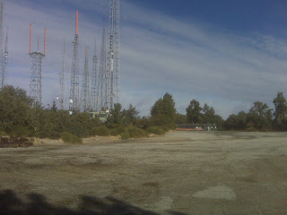
The famous antennas

Crowd: Recreational hikers
The easy part:The second part....starting in mile 8!
The challenging part:Long and steep climb
Price: N/A
Pacers:N/A
Timing:N/A
Qualifying: None
Official website: N/A
My 2 cents: Temperature differential between Chantry Flats and Mt. Wilson is large, make sure to carry another layer of clothing, especially if running in the fall/winter/early spring. Map of the park can be helpful too.

Thanks for reading and as always please don't hesitate to email/reach out with any questions.
Thanks!

runnersreviews.blogspot.com/


Completed Marathons Map


View Marathons Map in a larger map


MUST READ: By reading parts or all of this blog, the reader (“You”) understand that trying on your own, some or all of the reviews (in part or in full) in this blog is potentially hazardous activity. You should not participate in running or walking or jogging or any other form of physical activity (collectively known as “Activities”) on the trails or courses or races (collectively known as “Paths”) reviewed unless you are medically able and properly trained. In any event, your Activities taking place in the Paths reviewed in this blog will be solely at your own risk under your full responsibility and under no circumstances shall the author and owner of this blog have any liability for direct or indirect physical or mental damages/injuries or death or damage/loss to your valuables or belongings as a direct or indirect result of your decision to participate in Activities based on reviews in this blog.

The author of this blog does neither represent nor warrants that the reviews in this blog are accurate or provide accurate representation of the prevailing conditions including but not limited to course, weather, surface condition or animals at the time you will choose to participate in Activities based on the reviewed Paths. The reviews were accurate strictly for the time at which they were explored and ran or walked by the author and should not be relied upon for planning or doing your Activities.

These are mountain, unpaved trails and paved road courses; some are away from medical services. The Paths have numerous risk factors which include, just to name a few out of many others, rattlesnakes, coyotes, mountain lions, ticks, poison oak, and other potentially dangerous and harmful animals, vegetation, fire hazards,  and other dangerous and harmful elements. Wearing sun block will protect your skin and should be taken into your consideration before exposing your skin to the sun.

If you choose to participate in Activities based on one, some or all of the reviewed Paths you assume all risks associated with your Activities, including varying and/or existing potentially harmful or hazardous weather conditions including but not limited to high heat and/or humidity, varying and/or existing conditions of the trails and roads, animals, poison oak, and traffic on the Paths including travel to and from the Paths, and including but not limited to trips, slides or falls of cliffs or steep slopes and contacts with other participants, all such risks being known and appreciated by you, and including all direct or indirect injuries or death that may be suffered before, during, or after an Activities.

It is highly recommended to perform the Activities as part of a group of multiple people. In addition it is highly recommended that you will carry essentials which include but are not limited to at least 64 Oz. of water, 4 energy bars, map of the area with a marked course, watch, GPS, cellular phone and a first-aid kit.

By reading parts or all of this blog and choosing to run, walk or physically follow any of the courses, trails or races reviewed you for yourself and anyone entitled to act on your behalf, unconditionally and with no reservations waive and release the author and owner of this blog, its agents and representatives, and all sponsors, their representatives and successors from all claims or liabilities of any kind arising directly or indirectly out of your participation in Activities based on the reviews in this blog.


Santa Ynez Canyon / Eagle Peak / Trailer Canyon

12/11/2011 - Review and course map Santa Ynez Canyon / Eagle Peak / Trailer Canyon - Topanga State Park, CA
Loop scenic and moderately challenging course through cool canyons and on top of the ridge.
Course map and details are below.


Distance: 9.52 miles
Course: The run start and end points are at the intersection of Vereda De La Montura and Camino De Yatasto. The first part of the course is through Santa Ynez canyon that will connect after a good climb to E Topanga Fire Road. Make a right on the fire road towards Eagle Point and run around it until connected to Temescal Fire road and head south on the ridge until the intersection with Trailer Canyon Fire road, make a right and run down to the starting point
Crowd: Recreational hikers
The easy part: Once you'll make it up to E Topanga Fire road most of the climb is behind you and you can run for pace on the ridge and practice down hill on the way down to the end
The challenging part: Part of the climb up to the ridge from the canyon is steps, if you are not well trained this can be challenging
Price: N/A
Pacers:N/A
Timing:N/A
Qualifying: None
Official website: N/A
My 2 cents: This is one of my favorite courses, it enables me to train for both endurance and pace.

Thanks for reading and as always please don't hesitate to email/reach out with any questions.
Thanks!

runnersreviews.blogspot.com/


Completed Marathons Map


View Marathons Map in a larger map


MUST READ: By reading parts or all of this blog, the reader (“You”) understand that trying on your own, some or all of the reviews (in part or in full) in this blog is potentially hazardous activity. You should not participate in running or walking or jogging or any other form of physical activity (collectively known as “Activities”) on the trails or courses or races (collectively known as “Paths”) reviewed unless you are medically able and properly trained. In any event, your Activities taking place in the Paths reviewed in this blog will be solely at your own risk under your full responsibility and under no circumstances shall the author and owner of this blog have any liability for direct or indirect physical or mental damages/injuries or death or damage/loss to your valuables or belongings as a direct or indirect result of your decision to participate in Activities based on reviews in this blog.

The author of this blog does neither represent nor warrants that the reviews in this blog are accurate or provide accurate representation of the prevailing conditions including but not limited to course, weather, surface condition or animals at the time you will choose to participate in Activities based on the reviewed Paths. The reviews were accurate strictly for the time at which they were explored and ran or walked by the author and should not be relied upon for planning or doing your Activities.

These are mountain, unpaved trails and paved road courses; some are away from medical services. The Paths have numerous risk factors which include, just to name a few out of many others, rattlesnakes, coyotes, mountain lions, ticks, poison oak, and other potentially dangerous and harmful animals, vegetation, fire hazards,  and other dangerous and harmful elements. Wearing sun block will protect your skin and should be taken into your consideration before exposing your skin to the sun.

If you choose to participate in Activities based on one, some or all of the reviewed Paths you assume all risks associated with your Activities, including varying and/or existing potentially harmful or hazardous weather conditions including but not limited to high heat and/or humidity, varying and/or existing conditions of the trails and roads, animals, poison oak, and traffic on the Paths including travel to and from the Paths, and including but not limited to trips, slides or falls of cliffs or steep slopes and contacts with other participants, all such risks being known and appreciated by you, and including all direct or indirect injuries or death that may be suffered before, during, or after an Activities.

It is highly recommended to perform the Activities as part of a group of multiple people. In addition it is highly recommended that you will carry essentials which include but are not limited to at least 64 Oz. of water, 4 energy bars, map of the area with a marked course, watch, GPS, cellular phone and a first-aid kit.

By reading parts or all of this blog and choosing to run, walk or physically follow any of the courses, trails or races reviewed you for yourself and anyone entitled to act on your behalf, unconditionally and with no reservations waive and release the author and owner of this blog, its agents and representatives, and all sponsors, their representatives and successors from all claims or liabilities of any kind arising directly or indirectly out of your participation in Activities based on the reviews in this blog.