7/4/2012 - 14 miles trail run Mt. Baldy, review and a course map (QuintH / HHHHH)
Happy 4th! The genesis of the decision to spend the holiday running up Mt. Baldy, the highest mountain in LA county, goes back about 4 weeks ago when I signed up for the, arguably, highest altitude road marathon in Madison MT. The marathon course averages approximately 9,000 feet above sea level. So I thought that the Mt Baldy 14 miles, out and back, running up to more than 10,000 feet, can be a great prep run. I'd rank the run QuintH / HHHHH on my hRank system!
YES! this run and course up to the summit follows almost identically the course of the "Run To The Top" race. Hope this review can be helpful for those of you who plan to participate in "Run To The Top". (I ran last year, but the race got canceled b/c of thunder storms at the summit so I ran only up to the ski hut)
More details and review of the course with a map are below.
 |
| The start of Devil's Backbone Rd. |
 |
| Mt Harwood to the right of this trail |
 |
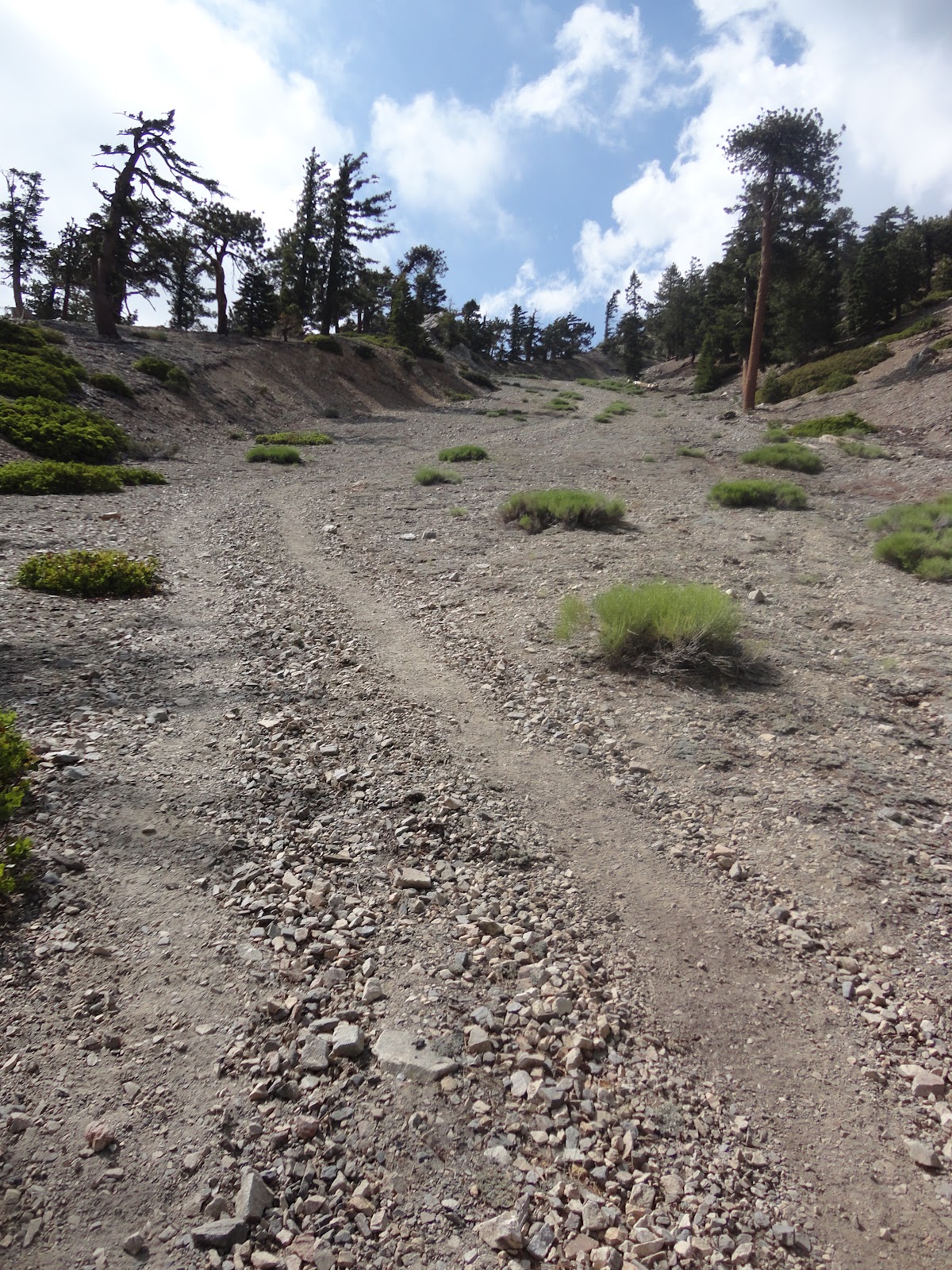
| Mt Baldy - steep and technical run |

 |
| Cloudy day....no views |


 |
| Really? |
Ranking: QuintH, High altitude course starting at 6,448 ft, Heat- started running in the low 80's, Hydration was carried on my back - no aid station, extremely Hilly course, running to more than 10,000 ft from about 6,100 ft, the first half of the run up to about 8,000 ft above sea level was Humid.
Distance: +14.19 miles (the reason for the "+" is because the GPS didn't measure all the curves and rather straight lined between points, so all in I ran more than 14.19 miles but that's the figure that was measured so listing that here)
Course: The trail run started in the end of Blady Rd at the parking lot of the chairlifts. I ran down on the paved road and made a right hand turn towards Baldy Falls, from there I ran on the fire road up to the ski hut. This part was about 4.5 miles and elevation gain of about 2,000 feet. This part of the course was hot and humid (I started at 2pm...) but the course was not technical with moderate slope.The fun part started when I got on Devils Backbone Road, though temperatures dropped and humidity was lower, the course got much more technical and the run up the mountain much steeper. Did I mention, much less air? You get the point. This leg up towards Mt. Harwood and then Mt Baldy was strenuous and challenging. Regarding the course, I just kept running up hill until there was no more hill to climb :). The way back to the starting point follows the same course up but reversed.
Crowd: recreational hikers, I was the only runner
The easy part: nothing was easy in this trail run
Crowd: recreational hikers, I was the only runner
The easy part: nothing was easy in this trail run
The challenging part: 6,000 to 10,000 above sea level, bring your own water and food, steep hills, technical course in the second half of the climb from 8,000 ft to 10,000 ft.
Price: Just recreation pass if parked down at Manker Flats.
Pacers:No
Timing:No
Qualifying: None
Official website: N/A
Completed Marathons Map
View Marathons Map in a larger map
My 2 cents:
1) If I could sleep the night before in the village to better acclimatize to the altitude I would have done it. I haven't and it made this run much more challenging.
2) I was thinking why this run was harder than Yosemite Falls and Cloud Rest trail runs and think that for different reasons. The Yosemite Falls trail run, though greater elevation gain, the run was at a lower altitude and shorter. The Cloud Rest run, though took place in similar altitudes, it had less elevation gain and I ran it after spending more than 24 hours in high altitude including the Yosemite Falls run.
3) I had just enough water, carrying 2 liters, to make it back to my car.
4) I would start earlier than 2pm when it is not that hot and humid
Thanks for reading and as always please don't hesitate to email/reach out with any questions.
Thanks!
runnersreviews.blogspot.com/
Tweet
1) If I could sleep the night before in the village to better acclimatize to the altitude I would have done it. I haven't and it made this run much more challenging.
2) I was thinking why this run was harder than Yosemite Falls and Cloud Rest trail runs and think that for different reasons. The Yosemite Falls trail run, though greater elevation gain, the run was at a lower altitude and shorter. The Cloud Rest run, though took place in similar altitudes, it had less elevation gain and I ran it after spending more than 24 hours in high altitude including the Yosemite Falls run.
3) I had just enough water, carrying 2 liters, to make it back to my car.
4) I would start earlier than 2pm when it is not that hot and humid
Thanks for reading and as always please don't hesitate to email/reach out with any questions.
Thanks!
Tweet
Completed Marathons Map
View Marathons Map in a larger map
MUST READ: By reading parts or all of this blog, the reader (“You”) understand that trying on your own, some or all of the reviews (in part or in full) in this blog is potentially hazardous activity. You should not participate in running or walking or jogging or any other form of physical activity (collectively known as “Activities”) on the trails or courses or races (collectively known as “Paths”) reviewed unless you are medically able and properly trained. In any event, your Activities taking place in the Paths reviewed in this blog will be solely at your own risk under your full responsibility and under no circumstances shall the author and owner of this blog have any liability for direct or indirect physical or mental damages/injuries or death or damage/loss to your valuables or belongings as a direct or indirect result of your decision to participate in Activities based on reviews in this blog.
The author of this blog does neither represent nor warrants that the reviews in this blog are accurate or provide accurate representation of the prevailing conditions including but not limited to course, weather, surface condition or animals at the time you will choose to participate in Activities based on the reviewed Paths. The reviews were accurate strictly for the time at which they were explored and ran or walked by the author and should not be relied upon for planning or doing your Activities.
These are mountain, unpaved trails and paved road courses; some are away from medical services. The Paths have numerous risk factors which include, just to name a few out of many others, rattlesnakes, coyotes, mountain lions, ticks, poison oak, and other potentially dangerous and harmful animals, vegetation, fire hazards, and other dangerous and harmful elements. Wearing sun block will protect your skin and should be taken into your consideration before exposing your skin to the sun.
If you choose to participate in Activities based on one, some or all of the reviewed Paths you assume all risks associated with your Activities, including varying and/or existing potentially harmful or hazardous weather conditions including but not limited to high heat and/or humidity, varying and/or existing conditions of the trails and roads, animals, poison oak, and traffic on the Paths including travel to and from the Paths, and including but not limited to trips, slides or falls of cliffs or steep slopes and contacts with other participants, all such risks being known and appreciated by you, and including all direct or indirect injuries or death that may be suffered before, during, or after an Activities.
It is highly recommended to perform the Activities as part of a group of multiple people. In addition it is highly recommended that you will carry essentials which include but are not limited to at least 64 Oz. of water, 4 energy bars, map of the area with a marked course, watch, GPS, cellular phone and a first-aid kit.
By reading parts or all of this blog and choosing to run, walk or physically follow any of the courses, trails or races reviewed you for yourself and anyone entitled to act on your behalf, unconditionally and with no reservations waive and release the author and owner of this blog, its agents and representatives, and all sponsors, their representatives and successors from all claims or liabilities of any kind arising directly or indirectly out of your participation in Activities based on the reviews in this blog.


